GPR · Depth slices
A layer-by-layer look beneath the surface
Depth slices generated from GPR data make buried structures visible metre by metre, each slice marking likely wall and infill traces at that depth.
The field experience of the team behind CERES®: end-to-end solutions from subsurface investigation to measurement hardware and software development.
2D and 3D ERT measurement and inversion. Subsurface lithology mapping, leak detection, pre-excavation ground investigation.
Groundwater and deep geoelectrical surveys.
High-resolution subsurface imaging. Utility detection, archaeological survey, concrete inspection.
Non-destructive geophysical surveys for buried structures and voids at archaeological sites.
Measurement instruments designed around your problem: from idea to reality.
Geophysical data processing, visualisation and field software, including 1D/2D/3D evaluation with the ELRIS inversion software.
TÜBİTAK 1501/1507 proposal writing, university–industry collaboration and technical feasibility studies.
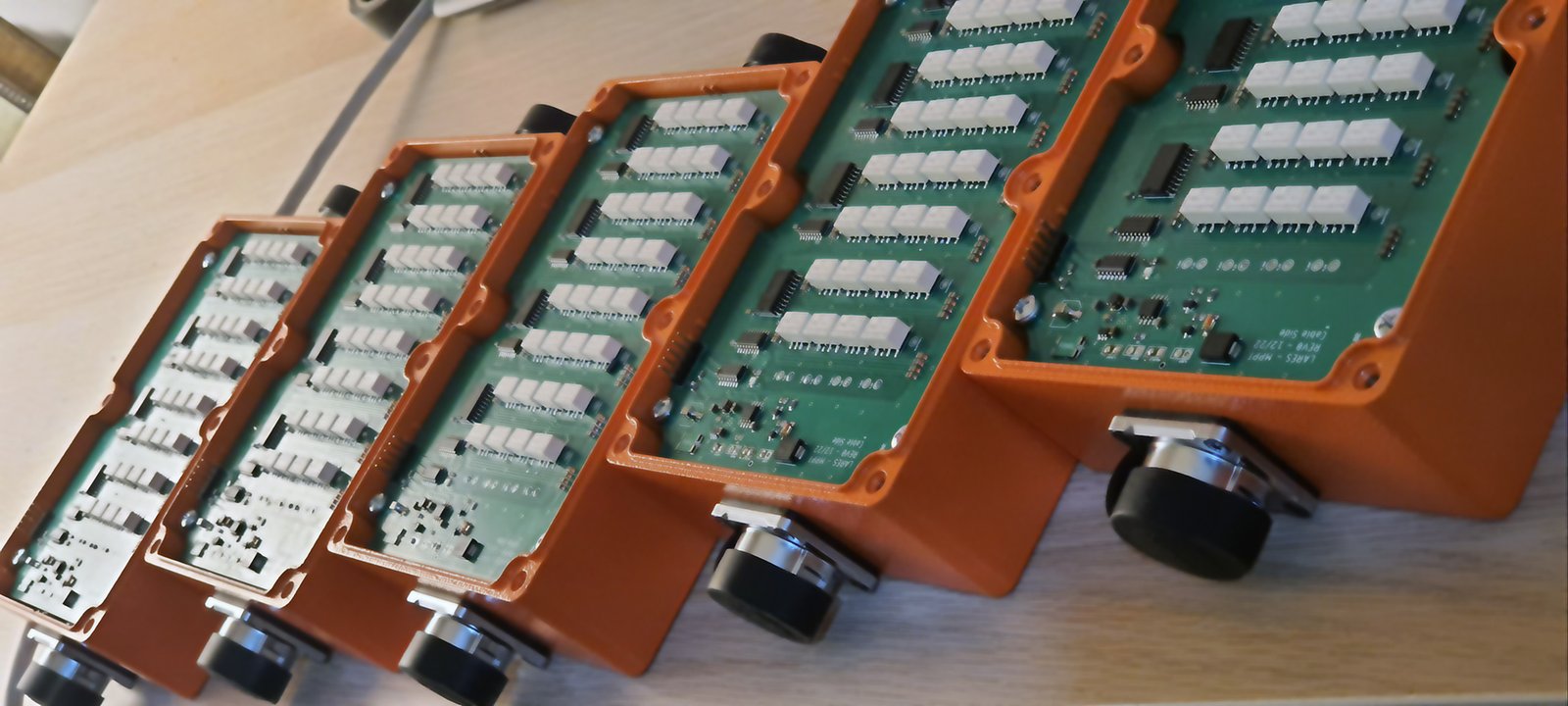
From the analog front-end, ADC integration and embedded system design to PCB production, the whole hardware development process is carried out in-house at LARES and MPPT. The same team also develops the web interface and data-processing software.
Depth slices, resistivity maps and field imagery from GPR and ERT data we have collected at ancient settlement sites.
Depth slices generated from GPR data make buried structures visible metre by metre, each slice marking likely wall and infill traces at that depth.
High-amplitude GPR reflections were overlaid on an aerial photo; this mapping helps position probable wall lines on the ground before excavation.
Resistivity data was visualised against the site's architectural plan; high-resistivity zones may point to stone foundations and floor remains.
A 3D model built from data collected at the ancient city of Apameia lets us examine the outline of a likely buried feature from every angle.
We clarify the goal, the site and your expectations together.
We choose the method, array and survey grid, and submit our proposal.
We run the measurements with our own instruments and cables, under quality control.
We process the data and deliver sections and interpretation.
We work with the rigour of science and academia, not commercial priorities.
Write to us about a field survey, instrumentation or R&D consulting.